The Support Center has moved!! See the new website https://support.goalexandria.com/ ![]()

How helpful was this page?
Related Blog Posts
Blog Posts
-
Maps makeover
created by
Nov 13, 2023
-
Map Out Spring, Map Out the Library
created by
Feb 01, 2016
Maps
Last Updated: $action.dateFormatter.formatDateTime($content.getLastModificationDate())

Maps
Maps Management
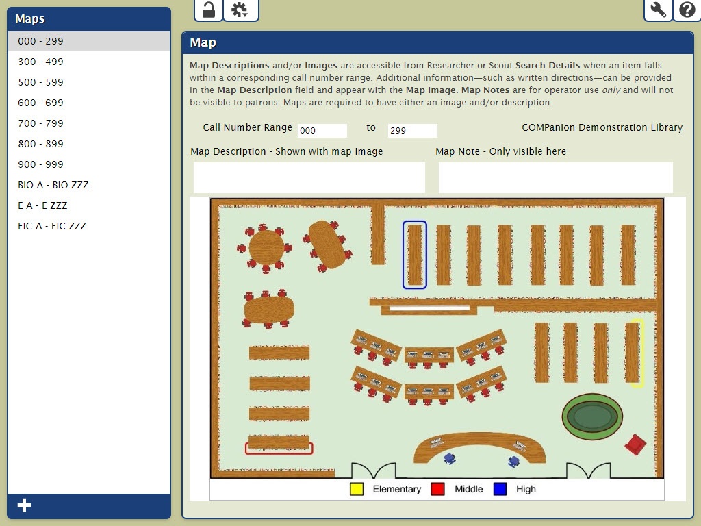
The Maps Management window allows you to construct simple guides that help patrons locate resources in your library.
Each map is associated with a call number range and is typically comprised of written directions, optional notes, and illustrative floor plans of your library.
When a Maps record (i.e. image and/or description) corresponds with a particular call number range (e.g. 800 to 899), a Show Map link is available in your Researcher and Scout Search Details.
This link will present the Map Description and Map Image associated with the item.
Maps navigation
The Maps Management window consists of two distinct areas:
- Maps list. The left-hand side of the Maps Management is a list containing the names of your current user-created maps. Selecting (highlighting) a map from this list will display the contents of the record in the right-hand side of the window.
- Maps pane. The larger, right-hand portion of the Maps Management window consists of the Map pane where the contents of the selected map record are displayed—in full—allowing you to modify their information or remove them completely.
Maps actions

Add Map. This creates a new, blank (unlocked for further editing) map in the Map pane of the Maps Management window.
Duplicate Map. This selection allows you to make a copy of the currently highlighted (i.e. selected) map.
Remove Map. Removes the currently highlighted (i.e. selected) map. Once saved, you can't restore deleted maps, so be careful!
Browse for Map Picture. This selection opens a standard browser explorer window, allowing you to guide Alexandria to the location of your locally saved image. This image will be applied to and displayed for the indicated Call Number Range. You can use nearly any image format (e.g. JPEGs, GIFs, PNGs, or BMPs) supported by your browser. Although they can be larger (or smaller), the optimal size for map pictures should be no larger than 960 pixels wide by 480 pixels high; if your image is larger, it will automatically be resized to fit our size specifications.
Remove Map Picture. This removes the map picture for the currently highlighted (i.e. selected) map. Once saved, you can't restore deleted map images, so be careful!